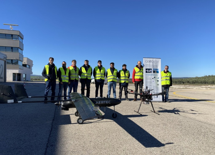
He Atlas Alpha Experimental Flight Center, based in Villacarillo (Jaén) recently hosted test flights of multicopters and fixed-wing UAS Taršíš25, in order to verify a new high-performance navigation system based on a signal receiver Galileo. This solution will enable reduced, collaborative separation between different drones operating simultaneously and improve operational safety at low altitudes.
The development was carried out within the project Geodesy (Galileo Enhanced Operation for Drone Systems), co-financed by the company European Space Agency (EUSPA) as part of a call Basic elements and led by a consortium of entities formed Aertec, PildoLabshe Advanced Center for Aerospace Technologies (Catec) and CTelecommunications Technology Center of Catalonia (CTTC).
High performance navigation system
This multi-frequency multi-constellation receiver will allow various drones to use data from positioning satellites. Galileo with centimeter accuracy, necessary to perform take-offs, navigation and landings autonomously and at low altitude (Very low level ), where operational requirements are more stringent.
In addition, through an authentication system against harmful interference, the received data is guaranteed to originate from the satellite Galileo and that they are not counterfeit. This authentication layer provides strong protection to the constellation and makes it a system GNSS (Global Navigation Satellite System) solid and safe.
The solution consists of Hardware needed to read satellite signals Galileo; same as in software requires the interpretation of these signals and the indication of the precise position of the UAS, meeting the technical and operational requirements to maintain safe separation between aircraft and reduce the risk of collision.
Role of Catec
Catec was responsible for integrating Geodesy into a multi-rotor platform that enables autonomous signal-assisted aircraft flight Galileo, a technological advance that represents a significant advance in the autonomy and efficiency of unmanned aerial systems.
The institution also participated in standardization groups such as Eurocae, ensure that technologies adhere to the highest industry standards; and led the creation of specialized guides for beneficiaries GNSS in the operation of drones at a risk level SAIL III. The conclusions of these manuals have served to create standards at the European level that support the safe and efficient development of unmanned aerial technologies.
Project system validation can help mitigate risks in the urban navigation environment, an advanced air mobility (AAM) industry that is rapidly developing at a technical level, but that needs initiatives of this type to progress in terms of operational safety.

